
Emma Wood topographic map
Interactive map
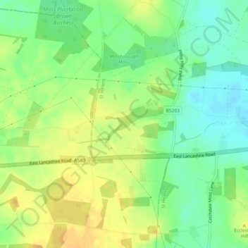
Click on the map to display elevation.
About this map
Name: Emma Wood topographic map, elevation, terrain.
Average elevation: 50 m
Minimum elevation: 36 m
Maximum elevation: 63 m
Other topographic maps
Click on a map to view its topography, its elevation and its terrain.
Rainhill
United Kingdom > England > St Helens
Rainhill, St Helens, North West England, England, United Kingdom
Average elevation: 59 m
St Helens
United Kingdom > England > St Helens > St Helens
St Helens, North West England, England, United Kingdom
Average elevation: 49 m