
Make a donation
Ba Den Mountain topographic map
Click on the map to display elevation.
Make a donation
Ba Den Mountain
In early December 1974 heavy combat in Tây Ninh began, with People's Army of Vietnam (PAVN) rockets falling on the province capital and on adjacent military installations. The 80-man 3rd Company, 314th Regional Force Battalion guarding the radio relay station on the summit of Nui Ba Den began receiving attacks of increasing intensity and frequency. Helicopter resupply and evacuation had become impossible, and although the company commander reported sufficient food and ammunition, water was running very short and several severely wounded men required evacuation. PAVN assaults on Nui Ba Den continued throughout December 1974, but the RF Company held on. RVNAF efforts to resupply the troops on Nui Ba Den were largely unsuccessful. Helicopters were driven off by heavy fire, and fighter-bombers were forced to excessive altitudes by SA-7 missiles and antiaircraft artillery. One F-5A fighter-bomber was shot down by an SA-7 on 14 December. Finally on 6 January 1975, without food and water and with nearly all ammunition expended, the company picked up its wounded and withdrew down the mountain to friendly lines.
Make a donation
About this map
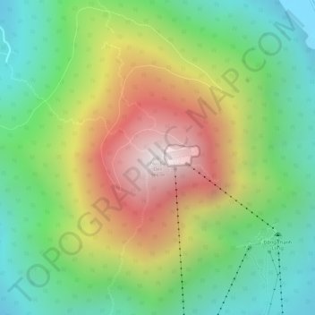
Name: Ba Den Mountain topographic map, elevation, terrain.
Average elevation: 441 m
Minimum elevation: 48 m
Maximum elevation: 965 m
Make a donation