
Steyr (Gsangwasser) topographic map
Interactive map
Click on the map to display elevation.
About this map
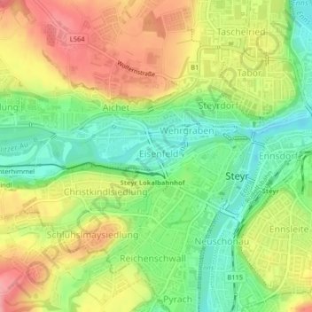
Name: Steyr (Gsangwasser) topographic map, elevation, terrain.
Average elevation: 331 m
Minimum elevation: 280 m
Maximum elevation: 387 m
Other topographic maps
Click on a map to view its topography, its elevation and its terrain.
Steyr
Österreich > Oberösterreich > Steyr
Steyr, Oberösterreich, 4407, Österreich
Average elevation: 378 m