
Point Lake topographic map
Interactive map
Click on the map to display elevation.
About this map
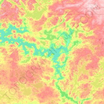
Name: Point Lake topographic map, elevation, terrain.
Average elevation: 441 m
Minimum elevation: 371 m
Maximum elevation: 562 m
Other topographic maps
Click on a map to view its topography, its elevation and its terrain.
Yellowknife
Canada > Northwest Territories > North Slave Region
Yellowknife, North Slave Region, Northwest Territories, Canada
Average elevation: 185 m
Horton Cresent Park
Canada > Northwest Territories > North Slave Region > Yellowknife
Horton Cresent Park, Frame Lake South, Yellowknife, North Slave Region, Northwest Territories, Canada
Average elevation: 187 m
Behchokǫ̀
Canada > Northwest Territories > North Slave Region > Behchokǫ̀
Behchokǫ̀, North Slave Region, Behchokǫ̀, Northwest Territories, X0E 0Y0, Canada
Average elevation: 166 m