
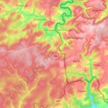
Martelange topographic map
Interactive map
Click on the map to display elevation.
About this map
Name: Martelange topographic map, elevation, terrain.
Location: Martelange, Arlon, Luxembourg, Wallonie, Belgique (49.77206 5.68456 49.85778 5.75854)
Average elevation: 447 m
Minimum elevation: 312 m
Maximum elevation: 520 m
Other topographic maps
Click on a map to view its topography, its elevation and its terrain.
Forêt d'Anlier
Belgique > Luxembourg > Arlon > Martelange
Forêt d'Anlier, Martelange, Arlon, Luxembourg, Wallonie, 6630, Belgique
Average elevation: 433 m