
Thank you for supporting this site ❤️
Make a donation
Make a donation
Lindbacka topographic map
Click on the map to display elevation.
Thank you for supporting this site ❤️
Make a donation
Make a donation
About this map
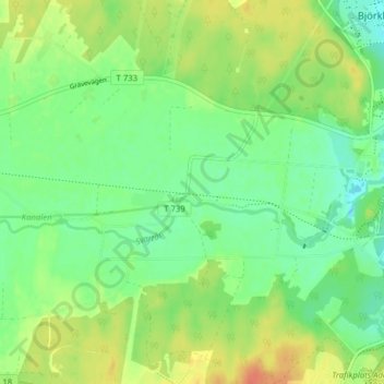
Name: Lindbacka topographic map, elevation, terrain.
Location: Lindbacka, Örebro, Örebro kommun, Örebro län, 705 93, Sverige (59.24743 15.09173 59.28743 15.13173)
Average elevation: 46 m
Minimum elevation: 29 m
Maximum elevation: 69 m
Thank you for supporting this site ❤️
Make a donation
Make a donation
Other topographic maps
Click on a map to view its topography, its elevation and its terrain.