
Make a donation
Zaragosa topographic map
Click on the map to display elevation.
Make a donation
About this map
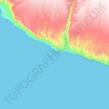
Name: Zaragosa topographic map, elevation, terrain.
Location: Zaragosa, Peru (-16.56472 -74.02083 -15.92472 -73.38083)
Average elevation: 525 m
Minimum elevation: 0 m
Maximum elevation: 2,137 m
Make a donation
Other topographic maps
Click on a map to view its topography, its elevation and its terrain.
Make a donation
Ica
Ica has significant wine and pisco industries, annual fiestas, a museum and historic colonial churches. The climate is generally sunny and dry due to its elevation above coastal fog and mist. As of 2020, the Peruvian desert, around the Huacachina Oasis, has gotten significantly popular among tourists for…
Average elevation: 1,624 m
Ancash
The park territory is very uneven. It has snowy summits, which altitudes vary between 5000 and 6768 MSL. It also has gullies, that are deeply encased because of the fluvioglacial erosion, and a great number of lagoons. Inside the borders of the park, there are 663 glaciers that are distributed throughout 180…
Average elevation: 2,121 m
Make a donation
Piura
Topography is smooth in the coast and rough in the Sierra. There are many arid plains in the southern region. The Sechura Desert, located south of the Piura River, is Peru's largest desert and one of the world's few examples of a tropical desert; it borders a tropical terrain to the north. The Bayóvar…
Average elevation: 675 m
Make a donation
Arequipa
This department has a rough topography, which is characterised by heavy layers of volcanic lava covering large areas of its inter-Andean sector. It has deep canyons such as the ones formed by the Ocoña and Majes rivers. Plateaus range in height from medium, such as La Joya, and high-altitude ones such the…
Average elevation: 2,599 m
Make a donation