Geolocate

Agupalo Este topographic map

Click on the map to display elevation.

About this map

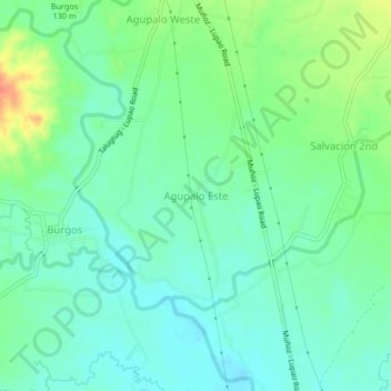
Name: Agupalo Este topographic map, elevation, terrain.

Location: Agupalo Este, Nueva Ecija, Central Luzon, Philippines (15.79301 120.86901 15.83301 120.90901)

Average elevation: 86 m

Minimum elevation: 71 m

Maximum elevation: 120 m

Other topographic maps

Click on a map to view its topography, its elevation and its terrain.

Quezon

Philippines > Nueva Ecija

Quezon, Nueva Ecija, Central Luzon, 3112, Philippines

Average elevation: 26 m

General Tinio

Philippines > Nueva Ecija

General Tinio, Nueva Ecija, Central Luzon, 3104, Philippines

Average elevation: 54 m

In order to remain free and to keep improving, this site uses cookies created by Google to compile visit statistics and display personalized advertisements.

How is the collected data used?