
Taher topographic map
Interactive map
Click on the map to display elevation.
About this map
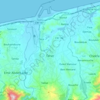
Name: Taher topographic map, elevation, terrain.
Location: Taher, Daïra Taher, Jijel, Algérie (36.72052 5.85782 36.83557 5.95109)
Average elevation: 57 m
Minimum elevation: -2 m
Maximum elevation: 622 m
Other topographic maps
Click on a map to view its topography, its elevation and its terrain.
Bazoul
Algérie > Jijel > Daïra Taher > Taher
Bazoul, Taher, Daïra Taher, Jijel, 18002, Algérie
Average elevation: 16 m