
Iłża topographic map
Interactive map
Click on the map to display elevation.
About this map
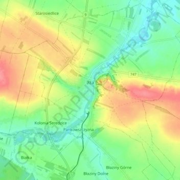
Name: Iłża topographic map, elevation, terrain.
Average elevation: 204 m
Minimum elevation: 174 m
Maximum elevation: 244 m
Other topographic maps
Click on a map to view its topography, its elevation and its terrain.
Pionki
Poland > Masovian Voivodeship > Radom County
Pionki, Radom County, Masovian Voivodeship, Poland
Average elevation: 159 m
Zatopolice
Poland > Masovian Voivodeship > Radom County > Zatopolice
Zatopolice, gmina Zakrzew, Radom County, Masovian Voivodeship, Poland
Average elevation: 188 m