
Thank you for supporting this site ❤️
Make a donation
Make a donation
Phagu topographic map
Click on the map to display elevation.
Thank you for supporting this site ❤️
Make a donation
Make a donation
About this map
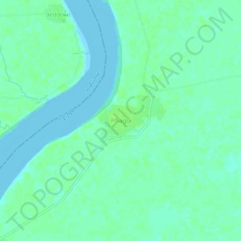
Name: Phagu topographic map, elevation, terrain.
Location: Phagu, Thanlyin, Thanlyin District, Yangon, Myanmar (16.90613 96.35132 16.94613 96.39132)
Average elevation: 4 m
Minimum elevation: -2 m
Maximum elevation: 9 m
Thank you for supporting this site ❤️
Make a donation
Make a donation
Other topographic maps
Click on a map to view its topography, its elevation and its terrain.