
Thank you for supporting this site ❤️
Make a donation
Make a donation
Goth Machi topographic map
Click on the map to display elevation.
Thank you for supporting this site ❤️
Make a donation
Make a donation
About this map
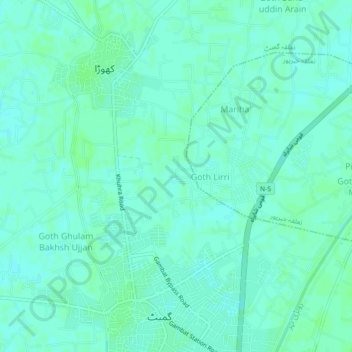
Name: Goth Machi topographic map, elevation, terrain.
Average elevation: 53 m
Minimum elevation: 50 m
Maximum elevation: 56 m
Thank you for supporting this site ❤️
Make a donation
Make a donation
Other topographic maps
Click on a map to view its topography, its elevation and its terrain.
Nara Canal
Left Bank Outfall Drain to the west of Nara Canal, built much later (starting in the 1960s and 80s) than Nara Canal, the LBOD was designed to solve the waterlogging and salinity problems caused by intensive irrigation from canals like the Nara. It collects salty groundwater and industrial/agricultural waste…
Average elevation: 37 m