
La Torre topographic map
Interactive map
Click on the map to display elevation.
About this map
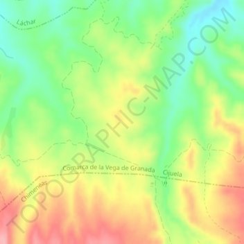
Name: La Torre topographic map, elevation, terrain.
Average elevation: 651 m
Minimum elevation: 594 m
Maximum elevation: 715 m
Other topographic maps
Click on a map to view its topography, its elevation and its terrain.
Cijuela
España > Andalucía > Comarca de la Vega de Granada > Cijuela
Cijuela, Comarca de la Vega de Granada, Granada, Andalucía, 18339, España
Average elevation: 604 m