
Thank you for supporting this site ❤️
Make a donation
Make a donation
Padagha topographic map
Click on the map to display elevation.
Thank you for supporting this site ❤️
Make a donation
Make a donation
About this map
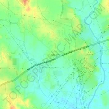
Name: Padagha topographic map, elevation, terrain.
Location: Padagha, Bhiwandi Taluka, Thane, Maharashtra, 421100, India (19.34684 73.15596 19.38684 73.19596)
Average elevation: 23 m
Minimum elevation: 8 m
Maximum elevation: 49 m
Thank you for supporting this site ❤️
Make a donation
Make a donation
Other topographic maps
Click on a map to view its topography, its elevation and its terrain.