
Thank you for supporting this site ❤️
Make a donation
Make a donation
Lukovit topographic map
Click on the map to display elevation.
Thank you for supporting this site ❤️
Make a donation
Make a donation
About this map
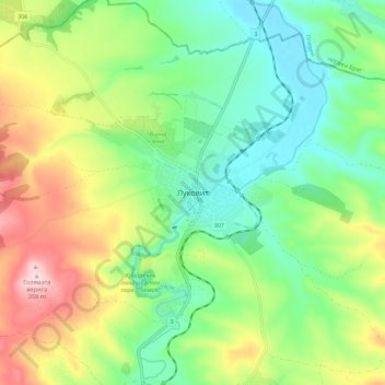
Name: Lukovit topographic map, elevation, terrain.
Location: Lukovit, Lovech, 5770, Bulgaria (43.16643 24.12191 43.24643 24.20191)
Average elevation: 197 m
Minimum elevation: 105 m
Maximum elevation: 358 m
Thank you for supporting this site ❤️
Make a donation
Make a donation
Other topographic maps
Click on a map to view its topography, its elevation and its terrain.
Thank you for supporting this site ❤️
Make a donation
Make a donation