
Buitenland topographic map
Interactive map
Click on the map to display elevation.
About this map
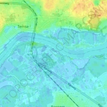
Name: Buitenland topographic map, elevation, terrain.
Location: Buitenland, Bornem, Malines, Anvers, Flandre, 2880, Belgique (51.09523 4.21144 51.13523 4.25144)
Average elevation: 6 m
Minimum elevation: -4 m
Maximum elevation: 27 m