
Manassas Park topographic map
Interactive map
Click on the map to display elevation.
About this map
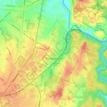
Name: Manassas Park topographic map, elevation, terrain.
Location: Manassas Park, Virginia, United States (38.74965 -77.47911 38.78835 -77.41939)
Average elevation: 79 m
Minimum elevation: 42 m
Maximum elevation: 106 m
Other topographic maps
Click on a map to view its topography, its elevation and its terrain.