
兰州新区 topographic map
Interactive map
Click on the map to display elevation.
About this map
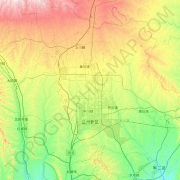
Name: 兰州新区 topographic map, elevation, terrain.
Location: 兰州新区, 兰州市, 甘肃省, 中国 (36.28722 103.44659 36.87489 103.91035)
Average elevation: 2,034 m
Minimum elevation: 1,607 m
Maximum elevation: 2,878 m
Other topographic maps
Click on a map to view its topography, its elevation and its terrain.