
Thank you for supporting this site ❤️
Make a donation
Make a donation
Gauribidanuru topographic map
Click on the map to display elevation.
Thank you for supporting this site ❤️
Make a donation
Make a donation
Gauribidanuru
Gauribidanur is at 13°37′N 77°31′E / 13.61°N 77.52°E / 13.61; 77.52. It has an average elevation of 694 metres (2276 feet).
Thank you for supporting this site ❤️
Make a donation
Make a donation
About this map
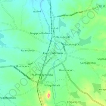
Name: Gauribidanuru topographic map, elevation, terrain.
Average elevation: 691 m
Minimum elevation: 667 m
Maximum elevation: 767 m
Thank you for supporting this site ❤️
Make a donation
Make a donation