
Thank you for supporting this site ❤️
Make a donation
Make a donation
Fort Mill topographic map
Click on the map to display elevation.
Thank you for supporting this site ❤️
Make a donation
Make a donation
About this map
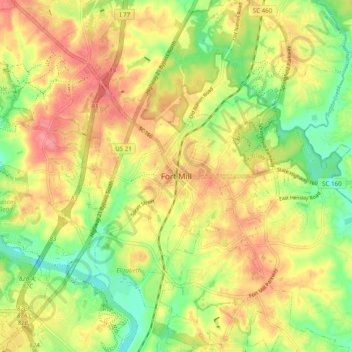
Name: Fort Mill topographic map, elevation, terrain.
Location: Fort Mill, York County, South Carolina, 29716, United States (34.96737 -80.98508 35.04737 -80.90508)
Average elevation: 182 m
Minimum elevation: 142 m
Maximum elevation: 218 m
Thank you for supporting this site ❤️
Make a donation
Make a donation