
Thank you for supporting this site ❤️
Make a donation
Make a donation
Oyrnafjall topographic map
Click on the map to display elevation.
Thank you for supporting this site ❤️
Make a donation
Make a donation
About this map
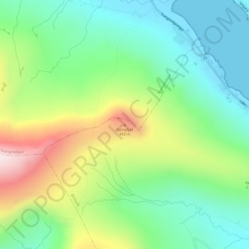
Name: Oyrnafjall topographic map, elevation, terrain.
Location: Oyrnafjall, Ørðavík, Suðuroyar sýsla, 827, Færøerne (61.54681 -6.85115 61.54691 -6.85105)
Average elevation: 191 m
Minimum elevation: -2 m
Maximum elevation: 561 m
Thank you for supporting this site ❤️
Make a donation
Make a donation