
Thank you for supporting this site ❤️
Make a donation
Make a donation
Lund topographic map
Click on the map to display elevation.
Thank you for supporting this site ❤️
Make a donation
Make a donation
About this map
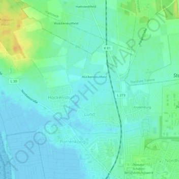
Name: Lund topographic map, elevation, terrain.
Location: Lund, Husum, Nordfriesland, Schleswig-Holstein, Deutschland (54.49204 9.03069 54.50740 9.05565)
Average elevation: 8 m
Minimum elevation: -4 m
Maximum elevation: 28 m
Thank you for supporting this site ❤️
Make a donation
Make a donation
Other topographic maps
Click on a map to view its topography, its elevation and its terrain.