
Thank you for supporting this site ❤️
Make a donation
Make a donation
Quonset Point topographic map
Click on the map to display elevation.
Thank you for supporting this site ❤️
Make a donation
Make a donation
About this map
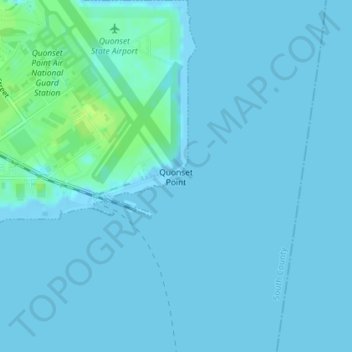
Name: Quonset Point topographic map, elevation, terrain.
Average elevation: 2 m
Minimum elevation: -6 m
Maximum elevation: 13 m
Thank you for supporting this site ❤️
Make a donation
Make a donation
Other topographic maps
Click on a map to view its topography, its elevation and its terrain.
Rabbit Island
United States > Rhode Island > South County > North Kingstown > Wickford
Average elevation: 10 m