
Crespel topographic map
Interactive map
Click on the map to display elevation.
About this map
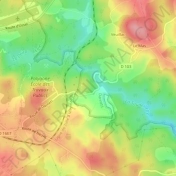
Name: Crespel topographic map, elevation, terrain.
Average elevation: 564 m
Minimum elevation: 505 m
Maximum elevation: 619 m
Other topographic maps
Click on a map to view its topography, its elevation and its terrain.
La Barrière
France > Nouvelle-Aquitaine > Corrèze > Darnets
La Barrière, Darnets, Ussel, Corrèze, Nouvelle-Aquitaine, France métropolitaine, 19300, France
Average elevation: 584 m
Genestine
France > Nouvelle-Aquitaine > Corrèze > Darnets
Genestine, Darnets, Ussel, Corrèze, Nouvelle-Aquitaine, France métropolitaine, 19300, France
Average elevation: 569 m