
Ranai topographic map
Interactive map
Click on the map to display elevation.
About this map
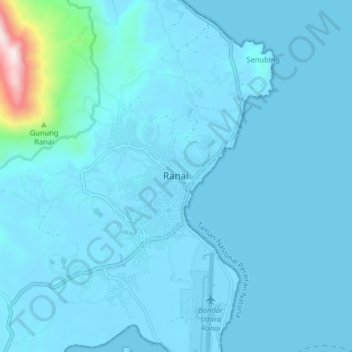
Name: Ranai topographic map, elevation, terrain.
Location: Ranai, Riau Islands, Indonesia (3.89829 108.34007 3.97829 108.42007)
Average elevation: 55 m
Minimum elevation: -3 m
Maximum elevation: 959 m