
Schaarbeek topographic map
Interactive map
Click on the map to display elevation.
About this map
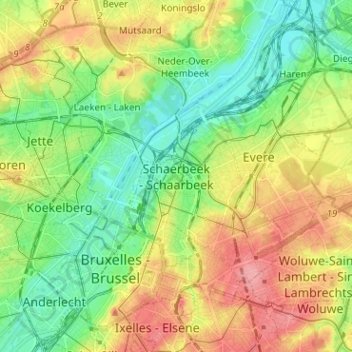
Name: Schaarbeek topographic map, elevation, terrain.
Location: Schaarbeek, Brussel-Hoofdstad, Brussel Hoofdstad, 10303, België (50.82760 4.33371 50.90760 4.41371)
Average elevation: 48 m
Minimum elevation: 10 m
Maximum elevation: 100 m