
Thank you for supporting this site ❤️
Make a donation
Make a donation
Tangen topographic map
Click on the map to display elevation.
Thank you for supporting this site ❤️
Make a donation
Make a donation
About this map
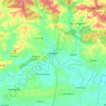
Name: Tangen topographic map, elevation, terrain.
Location: Tangen, Sragen, Central Java, Java, Indonesia (-7.37263 111.01789 -7.29263 111.09789)
Average elevation: 92 m
Minimum elevation: 60 m
Maximum elevation: 150 m
Thank you for supporting this site ❤️
Make a donation
Make a donation