
Thank you for supporting this site ❤️
Make a donation
Make a donation
Les Pages topographic map
Click on the map to display elevation.
Thank you for supporting this site ❤️
Make a donation
Make a donation
About this map
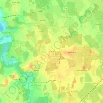
Name: Les Pages topographic map, elevation, terrain.
Average elevation: 270 m
Minimum elevation: 246 m
Maximum elevation: 286 m
Thank you for supporting this site ❤️
Make a donation
Make a donation
Other topographic maps
Click on a map to view its topography, its elevation and its terrain.
Étang des Vosges
France > Auvergne-Rhône-Alpes > Ain > Saint-Germain-sur-Renon > La Maison Neuve
Average elevation: 274 m