
Thank you for supporting this site ❤️
Make a donation
Make a donation
Jagupit topographic map
Click on the map to display elevation.
Thank you for supporting this site ❤️
Make a donation
Make a donation
About this map
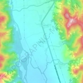
Name: Jagupit topographic map, elevation, terrain.
Location: Jagupit, Agusan del Norte, Caraga, 8608, Philippines (9.22130 125.53627 9.26130 125.57627)
Average elevation: 93 m
Minimum elevation: 20 m
Maximum elevation: 309 m
Thank you for supporting this site ❤️
Make a donation
Make a donation
Other topographic maps
Click on a map to view its topography, its elevation and its terrain.