
Wandelen topographic map
Interactive map
Click on the map to display elevation.
About this map
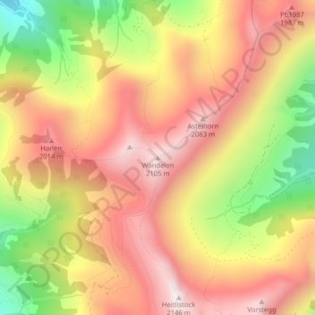
Name: Wandelen topographic map, elevation, terrain.
Location: Wandelen, Sachseln, Obwalden, 6067, Zwitserland (46.82274 8.24772 46.82284 8.24782)
Average elevation: 1,735 m
Minimum elevation: 1,205 m
Maximum elevation: 2,116 m