
Thank you for supporting this site ❤️
Make a donation
Make a donation
Koné topographic map
Click on the map to display elevation.
Thank you for supporting this site ❤️
Make a donation
Make a donation
About this map
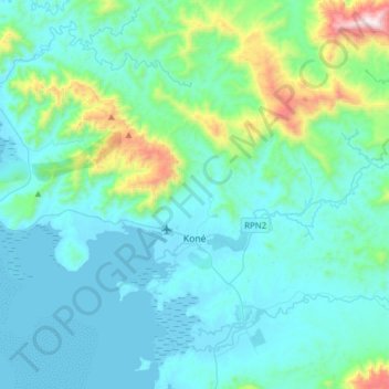
Name: Koné topographic map, elevation, terrain.
Location: Koné, North Province, New Caledonia, France (-21.11539 164.76443 -20.94139 165.07386)
Average elevation: 189 m
Minimum elevation: -1 m
Maximum elevation: 1,356 m
Thank you for supporting this site ❤️
Make a donation
Make a donation
Other topographic maps
Click on a map to view its topography, its elevation and its terrain.