
Thank you for supporting this site ❤️
Make a donation
Make a donation
Thursday Island topographic map
Click on the map to display elevation.
Thank you for supporting this site ❤️
Make a donation
Make a donation
About this map
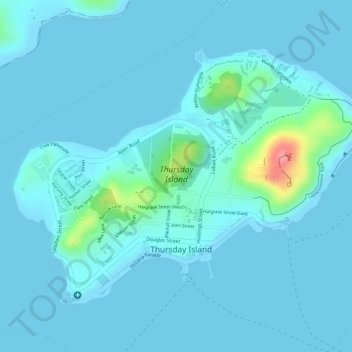
Name: Thursday Island topographic map, elevation, terrain.
Location: Thursday Island, Torres Shire, Queensland, 4875, Australia (-10.58865 142.20615 -10.56901 142.23364)
Average elevation: 10 m
Minimum elevation: 0 m
Maximum elevation: 102 m
Thank you for supporting this site ❤️
Make a donation
Make a donation