
Sanggau topographic map
Interactive map
Click on the map to display elevation.
About this map
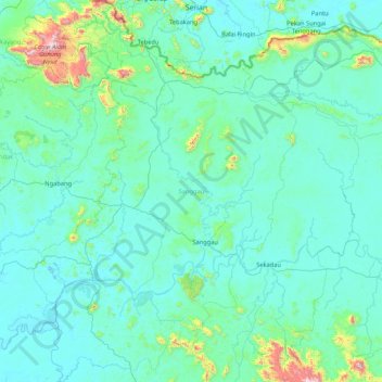
Name: Sanggau topographic map, elevation, terrain.
Location: Sanggau, West Kalimantan, Indonesia (-0.49952 109.84214 1.19993 111.01312)
Average elevation: 106 m
Minimum elevation: -1 m
Maximum elevation: 1,563 m
Other topographic maps
Click on a map to view its topography, its elevation and its terrain.