
Lahul and Spiti topographic map
Interactive map
Click on the map to display elevation.
About this map
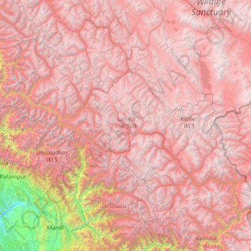
Name: Lahul and Spiti topographic map, elevation, terrain.
Location: Lahul and Spiti, Himachal Pradesh, India (31.75223 76.35852 33.25567 78.69266)
Average elevation: 4,276 m
Minimum elevation: 516 m
Maximum elevation: 6,611 m
Other topographic maps
Click on a map to view its topography, its elevation and its terrain.
Spiti
Spiti, Lahaul and Spiti District, Himachal Pradesh, India
Average elevation: 4,906 m
Batal
India > Himachal Pradesh > Batal
Batal, Solan, Himachal Pradesh, 173208, India
Average elevation: 1,122 m
Manali
India > Himachal Pradesh > Manali
Manali, Kullu, Himachal Pradesh, 175131, India
Average elevation: 2,606 m