
Hafr topographic map
Interactive map
Click on the map to display elevation.
About this map
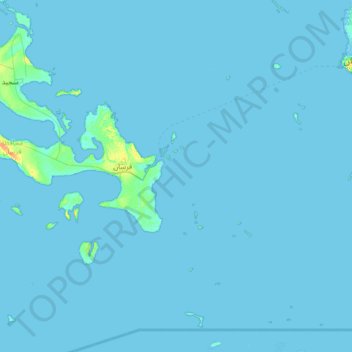
Name: Hafr topographic map, elevation, terrain.
Location: Hafr, Saudi Arabia (16.36389 41.89972 17.00389 42.53972)
Average elevation: 1 m
Minimum elevation: -1 m
Maximum elevation: 47 m
Other topographic maps
Click on a map to view its topography, its elevation and its terrain.
Al-Bahah Province
The region is divided by huge rocky steeps into two main sectors. To the west is a coastal plain, the Tihamah. To the east is the mountain range of al-As-Sarawat or the Sarat, with an elevation of 1,500 to 2,450 m (4,920 to 8,040 ft) above sea level.
Average elevation: 1,154 m
Rabigh
Rabigh (Arabic: رَابِغ, romanized: Rābigh) is a city and governorate in the Province of Makkah of the Kingdom of Saudi Arabia, situated on the coast of the Red Sea, around 208 km (129 mi) northwest of Mecca in the historic Hejazi region. The city had an estimated population of 180,352 in 2014 and is…
Average elevation: 145 m
Makkah Region
Most of the central and eastern portions of the province are desert, with the Hejaz mountains, which vary in elevation from 600 meters to 2000 meters, separating the relatively flat Nafud desert and coastal plains. Agriculture takes place in the region's many wadis and oases, with the most commonly-grown crops…
Average elevation: 785 m