
Kharkiv topographic map
Interactive map
Click on the map to display elevation.
Kharkiv
Based on Kharkiv's topography, the city can be conditionally divided into four lower districts and four higher districts.
About this map
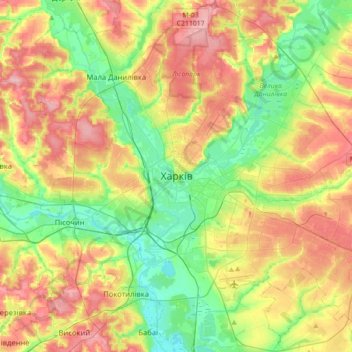
Name: Kharkiv topographic map, elevation, terrain.
Average elevation: 146 m
Minimum elevation: 92 m
Maximum elevation: 215 m