

Negros Occidental topographic maps
Click on a map to view its topography, its elevation and its terrain.


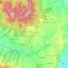

Cauayan
Philippines > Negros Occidental
The municipality of Cauayan has a rugged topography. Mt. Malipantao, considered the highest peak in the province, separates the municipality from the town of Candoni and the city of Sipalay. Portion of the ranges are the remaining thick forest that needs protection where the watershed is located. The remaining…
Average elevation: 93 m










Himamaylan City Public Plaza
Philippines > Negros Occidental > Himamaylan > Barangay Ⅲ
Average elevation: 5 m


About this place
Kabankalan • Cadiz • San Carlos • Murcia • Talisay • Bago • La Castellana • Victorias • Ilog • Silay • Don Salvador Benedicto • Sipalay • Himamaylan • La Carlota • Cauayan • Pontevedra • Escalante • Binalbagan • Sagay • Manapla • Hinigaran • San Enrique • Calatrava • Pulupandan • Bacolod • Enrique B. Magalona • Toboso • La Castellana • Isabela • Sagay • Himamaylan • Santa Cruz • Biak na Bato • Valladolid • Hinoba-an