
Perth topographic map
Interactive map
Click on the map to display elevation.
About this map
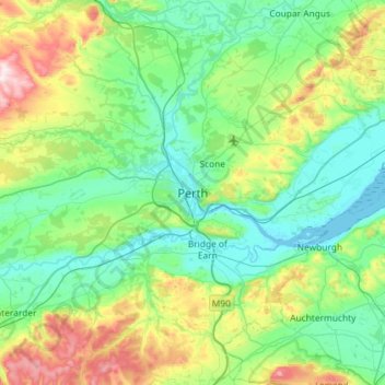
Name: Perth topographic map, elevation, terrain.
Location: Perth, Perth and Kinross, Écosse, PH1, Royaume-Uni (56.23577 -3.59355 56.55577 -3.27355)
Average elevation: 132 m
Minimum elevation: -1 m
Maximum elevation: 583 m
Other topographic maps
Click on a map to view its topography, its elevation and its terrain.
Drumderg
Royaume-Uni > Écosse > Perth
Drumderg, Perth, Perth and Kinross, Écosse, PH1, Royaume-Uni
Average elevation: 365 m