
Drumderg topographic map
Interactive map
Click on the map to display elevation.
About this map
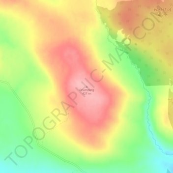
Name: Drumderg topographic map, elevation, terrain.
Location: Drumderg, Perth, Perth and Kinross, Écosse, PH1, Royaume-Uni (56.68299 -3.34221 56.68309 -3.34211)
Average elevation: 365 m
Minimum elevation: 295 m
Maximum elevation: 423 m
Other topographic maps
Click on a map to view its topography, its elevation and its terrain.
Perth
Royaume-Uni > Écosse > Perth
Perth, Perth and Kinross, Écosse, PH1, Royaume-Uni
Average elevation: 132 m