
Chinchiná topographic map
Interactive map
Click on the map to display elevation.
About this map
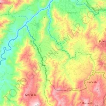
Name: Chinchiná topographic map, elevation, terrain.
Location: Chinchiná, Centrosur, Caldas, Región Andina, 176020, Colombia (4.92662 -75.74713 5.07766 -75.58067)
Average elevation: 1,487 m
Minimum elevation: 928 m
Maximum elevation: 2,686 m
Other topographic maps
Click on a map to view its topography, its elevation and its terrain.