
Chinchiná topographic map
Interactive map
Click on the map to display elevation.
About this map
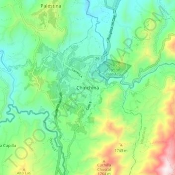
Name: Chinchiná topographic map, elevation, terrain.
Location: Chinchiná, Centrosur, Caldas, 176020, Colombia (4.94302 -75.64541 5.02302 -75.56541)
Average elevation: 1,465 m
Minimum elevation: 1,177 m
Maximum elevation: 2,163 m
Other topographic maps
Click on a map to view its topography, its elevation and its terrain.