
Thank you for supporting this site ❤️
Make a donation
Make a donation
Wilsede topographic map
Click on the map to display elevation.
Thank you for supporting this site ❤️
Make a donation
Make a donation
About this map
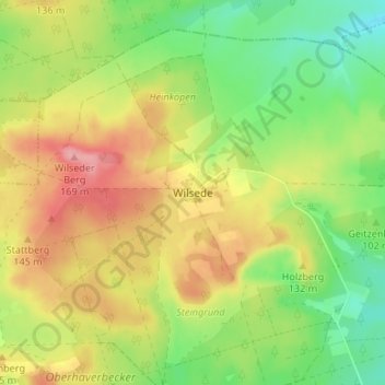
Name: Wilsede topographic map, elevation, terrain.
Location: Wilsede, Bispingen, Heidekreis, Lower Saxony, 21274, Germany (53.14389 9.94031 53.18389 9.98031)
Average elevation: 114 m
Minimum elevation: 66 m
Maximum elevation: 168 m
Thank you for supporting this site ❤️
Make a donation
Make a donation
Other topographic maps
Click on a map to view its topography, its elevation and its terrain.
Thank you for supporting this site ❤️
Make a donation
Make a donation
Thank you for supporting this site ❤️
Make a donation
Make a donation