
"Takamanda" topographic map
Interactive map
Click on the map to display elevation.
About this map
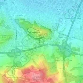
Name: "Takamanda" topographic map, elevation, terrain.
Location: "Takamanda", Nahne, Osnabrück, Basse-Saxe, 49082, Allemagne (52.23815 8.06544 52.25815 8.08544)
Average elevation: 102 m
Minimum elevation: 69 m
Maximum elevation: 181 m
Other topographic maps
Click on a map to view its topography, its elevation and its terrain.
Nette
Allemagne > Basse-Saxe > Osnabrück
Nette, Osnabrück, Basse-Saxe, 49088, Allemagne
Average elevation: 76 m