
Nette topographic map
Interactive map
Click on the map to display elevation.
About this map
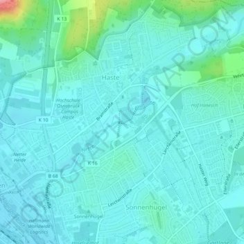
Name: Nette topographic map, elevation, terrain.
Location: Nette, Osnabrück, Basse-Saxe, 49088, Allemagne (52.30263 8.04879 52.30276 8.04892)
Average elevation: 76 m
Minimum elevation: 60 m
Maximum elevation: 169 m
Other topographic maps
Click on a map to view its topography, its elevation and its terrain.
"Takamanda"
Allemagne > Basse-Saxe > Osnabrück
"Takamanda", Nahne, Osnabrück, Basse-Saxe, 49082, Allemagne
Average elevation: 102 m