
Thank you for supporting this site ❤️
Make a donation
Make a donation
Rhüden topographic map
Click on the map to display elevation.
Thank you for supporting this site ❤️
Make a donation
Make a donation
About this map
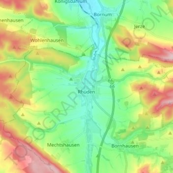
Name: Rhüden topographic map, elevation, terrain.
Location: Rhüden, Seesen, Landkreis Goslar, Niedersachsen, Deutschland (51.92423 10.07079 51.96351 10.19582)
Average elevation: 189 m
Minimum elevation: 114 m
Maximum elevation: 323 m
Thank you for supporting this site ❤️
Make a donation
Make a donation
Other topographic maps
Click on a map to view its topography, its elevation and its terrain.