
Lac Thor topographic map
Interactive map
Click on the map to display elevation.
About this map
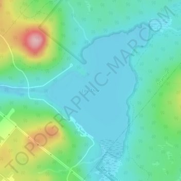
Name: Lac Thor topographic map, elevation, terrain.
Location: Lac Thor, Stratford, Le Granit, Estrie, Québec, Canada (45.76832 -71.24541 45.78839 -71.22347)
Average elevation: 336 m
Minimum elevation: 292 m
Maximum elevation: 475 m
Other topographic maps
Click on a map to view its topography, its elevation and its terrain.
Mont Aylmer
Mont Aylmer, Stratford, Le Granit, Estrie, Québec, Canada
Average elevation: 382 m