
Thank you for supporting this site ❤️
Make a donation
Make a donation
Baksa topographic map
Click on the map to display elevation.
Thank you for supporting this site ❤️
Make a donation
Make a donation
About this map
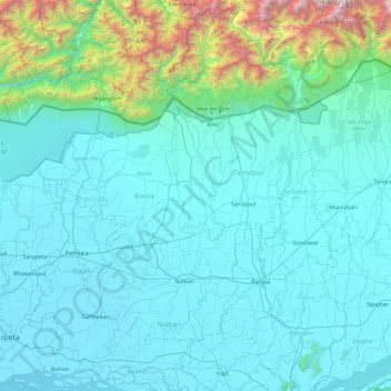
Name: Baksa topographic map, elevation, terrain.
Location: Baksa, Assam, India (26.41620 90.86620 26.83892 91.80114)
Average elevation: 335 m
Minimum elevation: 33 m
Maximum elevation: 2,902 m
Thank you for supporting this site ❤️
Make a donation
Make a donation
Other topographic maps
Click on a map to view its topography, its elevation and its terrain.