
Thank you for supporting this site ❤️
Make a donation
Make a donation
Beaver Mines topographic map
Click on the map to display elevation.
Thank you for supporting this site ❤️
Make a donation
Make a donation
About this map
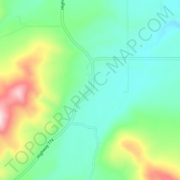
Name: Beaver Mines topographic map, elevation, terrain.
Location: Beaver Mines, Division No. 3, Alberta, Canada (49.43907 -114.21306 49.47907 -114.17306)
Average elevation: 1,345 m
Minimum elevation: 1,235 m
Maximum elevation: 1,630 m
Thank you for supporting this site ❤️
Make a donation
Make a donation
Other topographic maps
Click on a map to view its topography, its elevation and its terrain.
St. Mary Reservoir Provincial Recreation Area
Canada > Alberta > Division No. 3
Average elevation: 1,101 m