
Lougheed Island topographic map
Interactive map
Click on the map to display elevation.
About this map
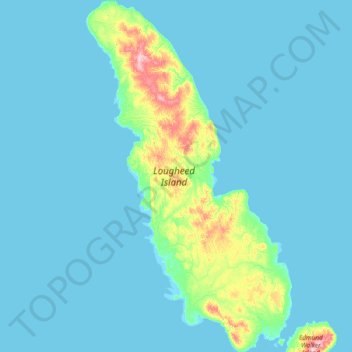
Name: Lougheed Island topographic map, elevation, terrain.
Location: Lougheed Island, Nunavut, Kanada (77.10792 -106.11751 77.76897 -104.34534)
Average elevation: 8 m
Minimum elevation: -2 m
Maximum elevation: 129 m
Other topographic maps
Click on a map to view its topography, its elevation and its terrain.