

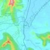
Nashik topographic map
Click on the map to display elevation.
Nashik
The city's tropical location and high altitude combine to give it a relatively mild version of a hot semi-arid climate (Köppen BSh). Temperatures rise slightly in October, but this is followed by the cool season from November to February. The cool season sees warm temperatures of around 28 °C or 82.4 °F during the day, but cool nights, with lows averaging 10 °C or 50 °F, and extremely dry air.
About this map

Name: Nashik topographic map, elevation, terrain.
Location: Nashik, Maharashtra, India (19.80421 73.55663 20.14023 73.95585)
Average elevation: 631 m
Minimum elevation: 523 m
Maximum elevation: 1,064 m
Other topographic maps
Click on a map to view its topography, its elevation and its terrain.
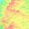
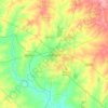
Solapur
India > Maharashtra > Solapur North
Solapur is located at 17°41′N 75°55′E / 17.68°N 75.92°E / 17.68; 75.92. It has an average elevation of 458 metres (1502 feet). It is bordered by Ahmednagar district on the north; Osmanabad district on the north and northeast.
Average elevation: 469 m


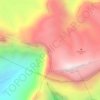


Malkapur
India > Maharashtra > Shahuwadi
Malkapur is located at 16°56′N 73°55′E / 16.93°N 73.92°E / 16.93; 73.92. It has an average elevation of 586 metres (1922 feet).
Average elevation: 581 m

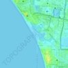

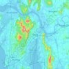


Sangamner
India > Maharashtra > Sangamner
Sangamner is located at 19°34′N 74°13′E / 19.57°N 74.22°E / 19.57; 74.22, on the banks of the Pravara River. It has an average elevation of 549 metres (1,801 ft)from mean sea level. Sangamner is the biggest settlement on NH 50 (New NH-60) between Pune (143 km distance) and Nashik (69 km…
Average elevation: 566 m





Pench (Indira Priyadarsini) National Park/Tiger Reserve
India > Maharashtra > Ramtek Taluka
Average elevation: 485 m




Gadahinglaj
India > Maharashtra > Gadhinglaj
Gadhinglaj is situated on the banks of the Hiranyakeshi river, which originates in the Amboli Ghats mountains. It is located at the border between Maharashtra and Karnataka. Maharashtra State Highway 134 passes through the city. Gadinglaj is the headquarters of South Kolhapur and a sub-district of the Kolhapur…
Average elevation: 655 m


